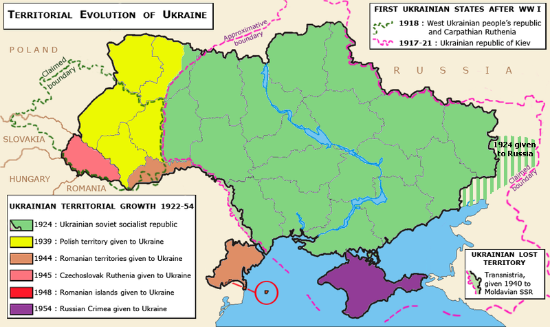
Map showing the territorial evolution of Ukraine in the 20th century. Map by Spiridon Ion Cepleanu
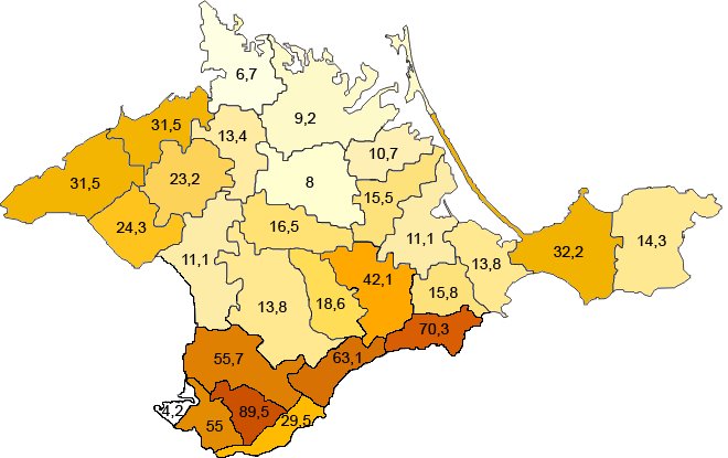
Percentage of Crimean Tatars by region in Crimea accroding to 1939 census
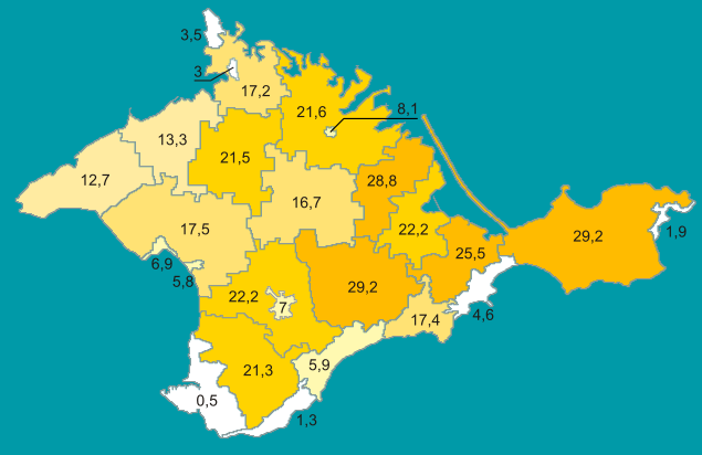
Percentage of Crimean Tatars in Crimea according to 2001 Ukrainian Census
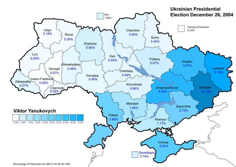
Yanukovych lost this election to Yushchenko with 44.2 percent of the vote compared to Yushchenko's 51.9 percent. The map, however, illustrates the regional divide.
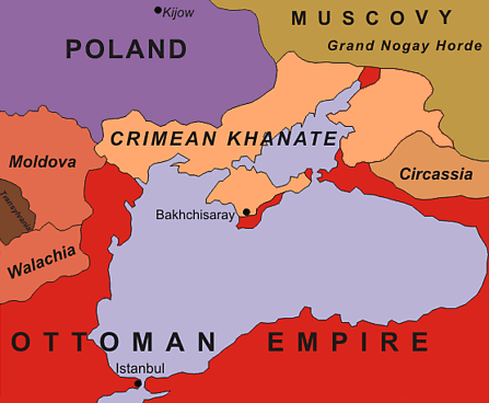
This map of the Black Sea Region in 1600 illustrates that the Crimean Khanate was a substantial power in the 17th century.
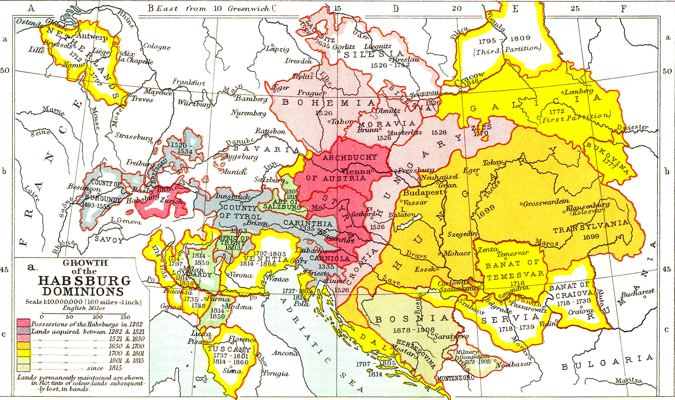
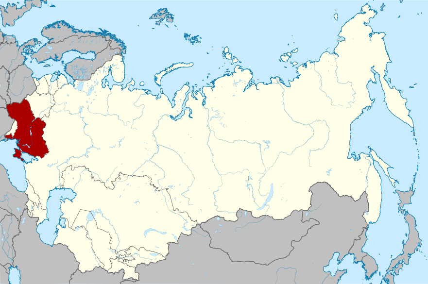
This map shows the growth of the Habsburg Austrian Empire. In the late 18th century, the westernmost region of Ukraine became part of this empire. The Habsburg emperors also acquired two smaller Ukrainian-populated areas from the Ottomans and the Hungarian Kingdom.
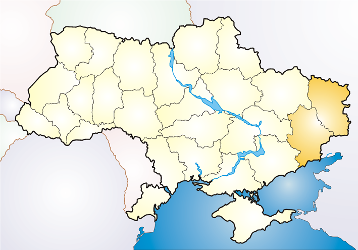
The Donbas region (short for Donets Basin) is the most populated region of Ukraine today although it is also an economically depressed industrial and mining area.
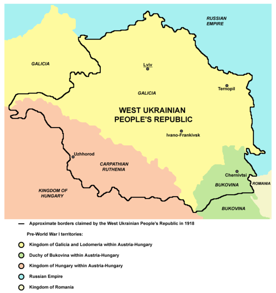
The Western Ukrainian People's Republic was established in Galicia after WWI but soon merged with the Ukrainian People's Republic with its capital in Kyiv.
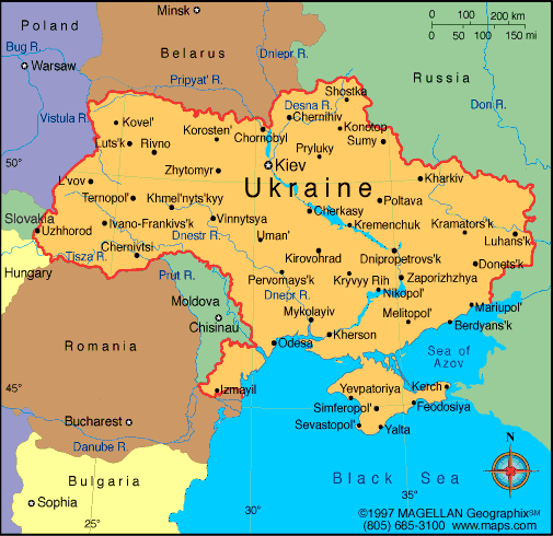
This political map shows Ukraine and many of its major cities, prior to the events of the crisis in Crimea.

Map showing support for Yanukovych in the 2010 Presidential election