Almost as soon as European settlers arrived in California they began advertising the place as the American Garden of Eden. And just as quickly people realized it was a garden with a very precarious water supply. Currently, California is in the middle of a years-long drought and the water crisis is threatening the region’s vital agricultural economy, not to mention the quality of life of its people, plants, and animals. This month B. Lynn Ingram, Professor of Geography and Earth & Planetary Science, examines how a deep historical account of California's water patterns can help us plan for the future.
Read more from Origins on Water and the Environment: The World Water Crisis; The River Jordan; Who Owns the Nile?; The Changing Arctic; Over-Fishing in American Waters; Climate Change and Human Population; and the Global Food Crisis.
The state of California is beginning its fourth year of a serious drought, with no end in sight.
The majority of water in the western United States is delivered by winter storms from the Pacific, and over the past year, those storms were largely blocked by an enormous ridge of high pressure. A relatively wet December has given way to the driest January on record, and currently over 90 percent of California is in severe to exceptional drought.
The southwestern states are also experiencing moderate to severe drought, and this comes on the heels of a very dry decade. This long drought has crept up on the region, partly because droughts encroach slowly and they lack the visual and visceral effects of other, more immediate natural disasters such as earthquakes, floods, or tsunamis.
Meteorologists define drought as an abnormally long period of insufficient rainfall adversely affecting growing or living conditions. But this bland definition belies the devastation wrought by these natural disasters. Drought can lead to failed crops, desiccated landscapes, wildfires, dehydrated livestock, and in severe cases, water wars, famine, and mass migration.
Although the situation in the West has not yet reached such epic proportions, the fear is that if it continues much longer, it could.
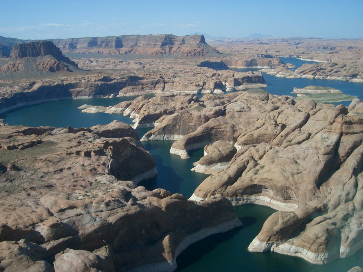 |
| Lake Powell, in 2009, showing a white calcium carbonate “bathtub ring” exposed after a decade of drought lowered the level of the reservoir to 60 percent of its capacity. (Photo courtesy of U.S. Bureau of Reclamation.) |
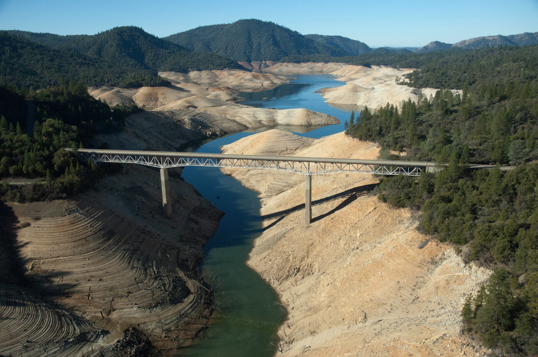
In California, reservoirs are currently at only 38 percent of capacity, and the snowpack is only 25 percent of normal for late January. Elsewhere in the Southwest, Lake Powell, the largest reservoir on the Colorado River, is at 44 percent of capacity.
The amount of water transported through irrigation systems to California’s Central Valley—the most productive agricultural region in the world—has been reduced to only 20 percent of customary quantities, forcing farmers to deepen groundwater wells and drill new ones.
Over the past year, 410,000 acres have been fallowed in this vast agricultural region that provides 30 percent of all the produce grown in the United States and virtually all of the world’s almonds, walnuts, and pistachios. As California dries up, food prices might well rise across the nation.
The question on everyone’s mind is when will this dry period finally come to an end and rainfall return to normal—and just what is normal for the U.S. Southwest when it comes to rain?
And with a growing and more urban population and an ever-changing climate, will we ever be free from the threat of long dry periods, with their disruptive effects on food production and the plants and animals that rely on water to survive?
A glance into the history of the Southwest reminds us that the climate and rainfall patterns have varied tremendously over time, with stretches of drought many decades longer than the one we are experiencing now.
Long dry stretches during the Medieval centuries (especially between 900 and 1350 CE) had dramatic effects on the native peoples of the Southwest (the ancestral Pueblo, Hohokam, and Sinagua), including civilizational collapse, violence, malnutrition, and forced social dislocation.
These earlier Americans are a warning to us.
The past 150 years, which we have used as our baseline for assumptions about rainfall patterns, water availability for agriculture, water laws, and infrastructure planning, may in fact be an unusually wet period.
Let’s look at the past few hundred years first and then explore the region’s climate in geological time.
Recent Droughts and the Arid Regions of the United States
John Wesley Powell stands as one of the most extraordinary scientists and explorers in America in the second half of the 19th century.
In 1869 he became the first white man to lead an expedition down the Colorado River and through the Grand Canyon, a feat all the more remarkable considering Powell had lost most of his right arm during the Civil War.
Ten years later, Powell published Report on the Lands of the Arid Regions of the United States, a careful assessment of the region’s capacity to be developed.
In it, Powell argued that very little of the West could sustain agriculture. In fact, his calculations suggested that even if all the water in western streams were harnessed, only a tiny fraction of the land could be irrigated.
Further, Powell believed that growth and development ought to be carefully planned and managed, and that boundaries drawn for new western states ought to follow watersheds to avoid inter-state fighting over precious water resources.
When Powell presented his findings to Congress, politicians howled. Powell found himself denounced by pro-development forces, including railroads and agricultural interests.
Prescient as Powell’s study has proved to be, it was almost entirely ignored at the time.
Instead, those development boosters responded to Powell’s data about the aridity of the west with a novel climatological theory: “Rain follows the plow.” They insisted that agriculture could cause the rains to fall, so like magic the more acres brought under cultivation the more rain farmers would enjoy.
The years surrounding the turn of the 20th century turned out to be unusually wet across much of the region. Hopeful pioneers continued to flock to the West, despite the visible signs of aridity.
They still do. The past century and a half in California and the West has been a period of steady population growth. And today the U.S. Southwest is the fastest-growing region in the United States (which itself is the world’s fourth-fastest-growing nation).
The Dirty Thirties and Beyond
The relatively wet period of the late nineteenth and early twentieth centuries gave way to drought in the late 1920s with the start of the Dust Bowl—now considered to be the United States’ worst climate tragedy.
The years between 1928 and 1939 were among the driest of the 20th century in the American West. This drought had particularly severe effects on California’s developing agricultural industry that were only mitigated by the extensive pumping of groundwater that eventually caused the ground surface in California’s Central Valley to drop by several feet.
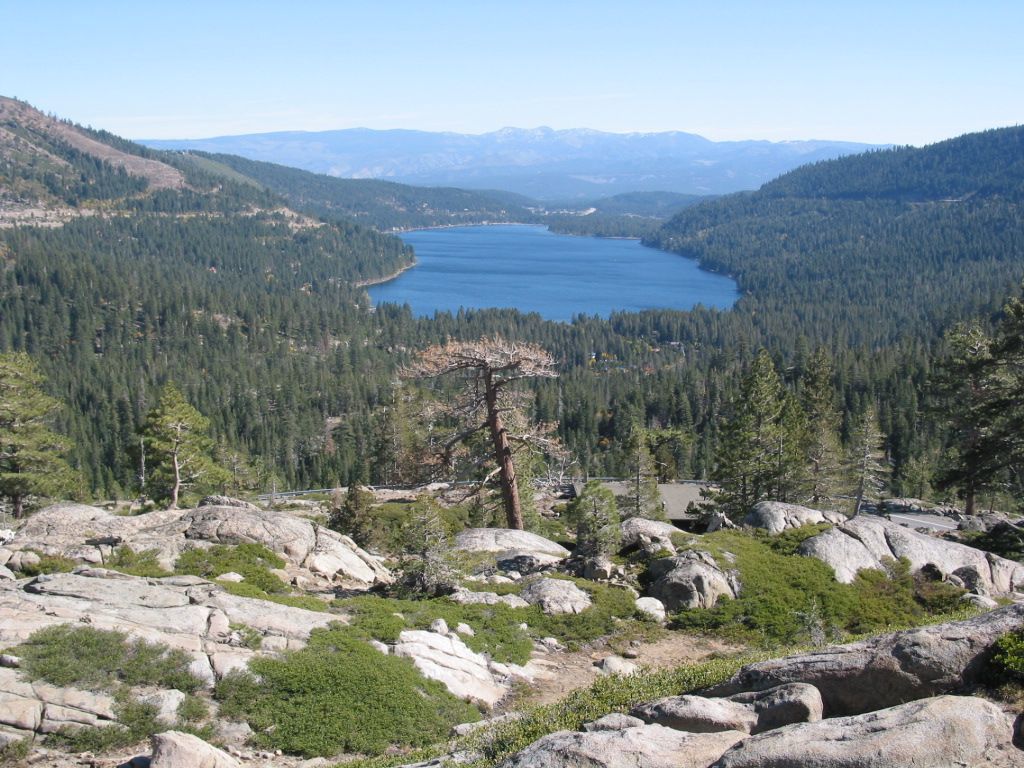 |
| Donner Lake, Sierra Nevada Range, California (Photo taken by B. Lynn Ingram). |
In the 20th century, the single driest year (rivaling the 2013-2014 water year) was the drought of 1976-1977, extending across the entire state of California and into the Northwest, the Midwest, and the Canadian Prairie region north of Montana.
In California, precipitation levels dropped to less than a quarter of average. Reservoirs dropped to one-third their normal levels, and 7.5 million trees in the Sierra Nevada weakened by drought succumbed to insect related diseases, fueling massive wildfires. Snowfall was extremely sparse, forcing ski areas to close.
The following decade, another six-year drought occurred from 1987 to 1992, and while no single year was as severe as the drought of 1976-1977, the cumulative effects were ultimately more devastating. Annual precipitation attained only 50 percent of the 20th century average, with far-ranging impacts.
In the Sierra Nevada, water-stressed trees suffered widespread mortality from pine bark beetle infestations. Reduced stream flow caused major declines in fish populations, affecting commercial and recreational fisheries by lowering populations of Chinook salmon and striped bass.
By the fourth year of the drought, reservoir storage statewide was down 60 percent, causing a decline in hydroelectric power generation and the imposition of water restrictions including a decrease in agricultural water delivery by 75 percent.
Farmers relied more on groundwater, with private well owners deepening existing wells or drilling new ones. In the San Joaquin Valley, 11 million acre-feet more groundwater was extracted than could be replenished naturally, further lowering already low groundwater levels.
Measuring Droughts over Geological Time
As bad and worrisome as these more recent historical droughts in California and the West were, they pale in comparison to events uncovered in the geological record.
In recent years, earth scientists have been discovering that the climate and weather in the West over the past 100 to 150 years represents only a narrow part of the full range of climate in the region.
By peering deeper into Earth’s history—the past centuries and millennia—the frequency and magnitude of extreme climate events like drought can be better understood.
The evidence comes in various forms, such as mud from the bottom of lakes and ponds, microscopic organisms living in the oceans, bubbles frozen in glaciers, pencil-thin wood cores drilled from trees, and salts precipitating in dried-up lake bottoms.
 |
| A cut section of a Giant Sequoia trunk from Tuolumne Grove, Yosemite National Park, California, showing AD dates of fires (photo courtesy of Thomas Swetnam, Laboratory of Tree-Ring Research, University of Arizona). |
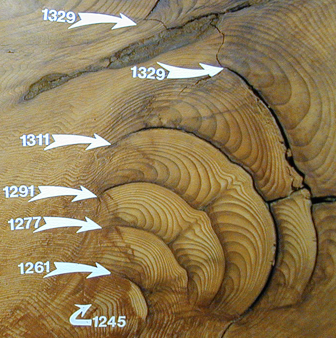
One of the earliest records of past climate change comes from the rings of the long-lived Douglas fir. Trees are particularly effective recorders of climate because they respond every year to conditions of temperature and precipitation, responses recorded in the growth rings of their trunks.
In a landmark study during the early 1940s, a 600-year record of Colorado River flow using Douglas firs revealed several sustained periods of low water flow and these periods recurred with some regularity.
The reconstruction showed a particularly severe drought in the late 1500s, a drought lasting over a decade that has since shown up in multiple records from throughout the West.
These records also reveal that the driest single year over the past millennium (even drier than the parched 1976-1977 drought) occurred in 1580 CE. Trees across the West either had a narrow ring, or even a missing ring, that year.
Looking at an even broader picture, evidence from the past 10 millennia—a relatively warm era since the last Ice Age, which we call the Holocene—informs us that the severity of past extreme events (including droughts and floods) far exceeds those experienced over the past century and a half.
One of the longest dry periods for California and the West occurred during what is known as the mid-Holocene climatic optimum, a time when much of the earth experienced warmer than average conditions from about 4,500 to 7,500 years ago.
In the American West, there are numerous clues showing that this time period was drier than average for upwards of 1,400 years. These climate extremes caused significant human dislocations and forced native populations to migrate from the desert interiors of the West to the coastal regions.
The Tools for Uncovering Climate History
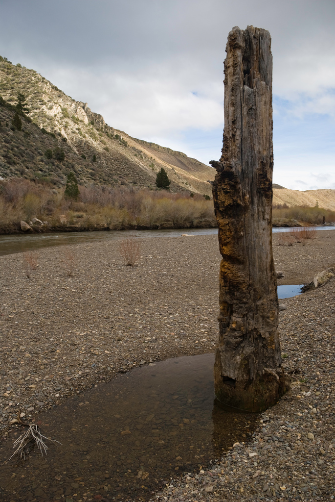
One of the most vivid clues for understanding the patterns of past drought in the West was revealed in Lake Tahoe toward the end of the Great Dust Bowl of the mid-1930s. At that time, Tahoe’s water level dropped fourteen inches, exposing a mysterious clustering of tree stumps sticking up from the water’s surface along the lake’s southern shore.
These trees attracted the attention of Samuel Harding, an engineering Professor from the University of California, Berkeley. Harding discovered that the trees were large, with trunks as wide as three feet in diameter, and appeared to be firmly rooted in the lake bottom.
Harding reasoned that the trees had grown in this location for a long time to attain such sizes, and since they were now submerged in over twelve feet of water, he surmised that at some time in the past the lake level had been much lower.
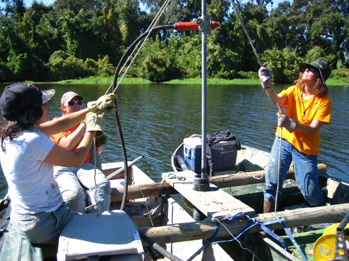 |
| Frances Malamud-Roam, B. Lynn Ingram, and Christina Brady coring a small oxbow lake in the Sacramento Valley, California. (Photo taken by Anders Noren, University of Minnesota, LaCore curator.) |
After collecting cores through their trunks, he counted up to 150 rings, concluding that it was a dry spell of over a century that caused the lake level to drop, allowing the trees to grow along the former shoreline.
Harding had to wait two decades before he could date this drought, after the invention of radiocarbon dating in the 1950s. Radiocarbon measurements of the outermost rings of the tree stumps showed that these trees died approximately 4,800 years ago.
Decades later, more evidence emerged from Lake Tahoe during another of California’s droughts in the late 1980s, when the lake’s surface dropped again, exposing even more tree stumps.
This time, it was an archaeologist, Susan Lindstrom, who noticed the tops of trees sticking out of the water along Tahoe’s southern shore. Donning scuba gear, Lindstrom was able to find fifteen submerged tree stumps that had escaped Harding’s attention, some measuring up to three and a half feet in diameter.
The radiocarbon dates from this much larger population of trees refined and extended the boundaries of the mid-Holocene drought, moving the beginning to as early as 6,290 years ago, and the ending to 4,840 years ago.
These stumps, located deeper in the lake, showed that the lake level had dropped by even more than Harding originally thought – by more than 20 feet. Lindstrom and other researchers have since located tree stumps in more places around the shores of Lake Tahoe and in other Sierran lakes.
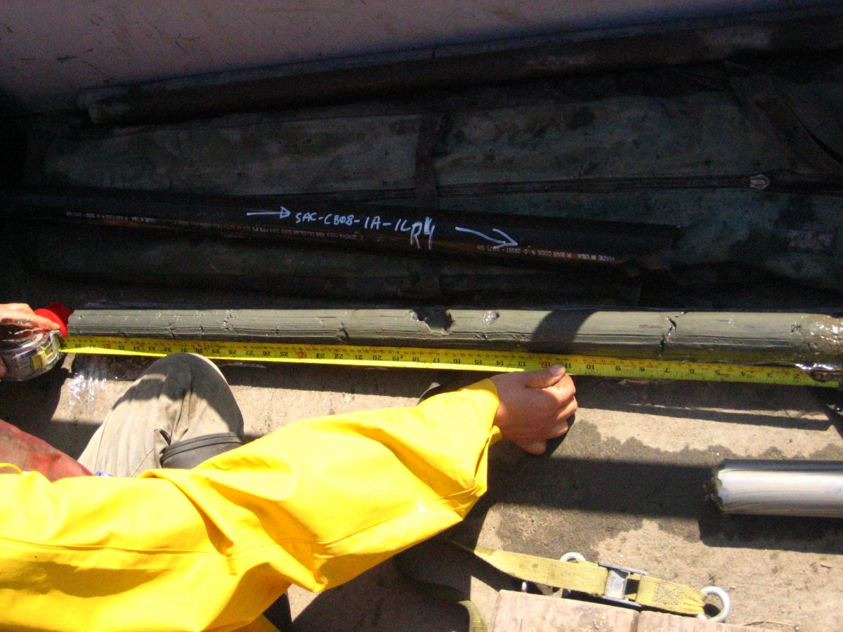 |
| Sediment core taken by Frances Malamud-Roam and B. Lynn Ingram from beneath San Francisco Bay, California. (Photo taken by B. Lynn Ingram.) |
Geologists have also discovered more evidence from sediment cores taken from beneath lakes revealing the wide extent of this drought—across California and the Great Basin.
The archaeological records show that native populations migrated from the inland desert regions to the California coast at this time, likely in search of water and other resources during this prolonged drought.
Another dry millennium began about 3,000 years after the mid-Holocene drought ended. Evidence for this prolonged drought was found throughout California and the West.
One study, conducted in my laboratory at UC Berkeley, examined sediments accumulating beneath the San Francisco Bay estuary. These sediments contain information about precipitation over the entire drainage basin of the Sacramento and San Joaquin Rivers—an area that covers 40 percent of California.
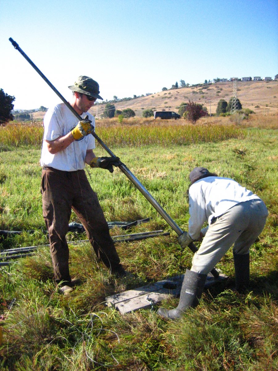 |
| Frances Malamud-Roam and Anders Noren coring marsh sediments adjacent to San Francisco Bay (Photo taken by B. Lynn Ingram) |
Rivers draining the Sierra Nevada Range and Central Valley flow through San Francisco Bay and out the Golden Gate to the Pacific Ocean. In the Bay, fresh river water meets and mixes with the incoming ocean water, producing a range of salinity: fresh at the Delta, saline in the Central bay near the Golden Gate, and brackish in between.
Organisms growing in the Bay record the salinity in their shells, which then sink to the bottom and are preserved in the sediments. We took sediment cores from beneath the Bay and analyzed the chemistry of the fossil shells, allowing us to reconstruct past salinity, and therefore past river flow.
These studies showed that droughts lasting over a decade occurred regularly over the past two millennia, at intervals of 50 to 90 years. The cores also revealed a period of high salinity that began about 1,700 years ago and ending about 700 years ago, suggesting another prolonged drought.
We conducted a related study with Professor Roger Byrne in the Geography Department at UC Berkeley, coring the tidal marshlands surrounding the bay to assess the impact of this drought on this ecosystem.
These marshes have grown up around the edges of San Francisco Bay for the past 5,000 years or so, forming peat. The marsh peats contain fossil plants and chemical evidence for past periods of wetter and drier conditions in the watershed.
A drought in the watershed, if prolonged and severe, can cause higher salinity downstream in the estuary as the inflow of fresh water drops. In response, salt-tolerant species in the marshes expand further inland toward the Delta and the fresh water species retreat. Conversely, unusually wet winters generate fresher conditions in the estuary, leading to an expansion of freshwater-adapted species.
We analyzed the pollen and plant remains, carbon chemistry of the peats, and diatoms—the microscopic phytoplankton that grow in the marshes and produce tiny silica shells.
All of this evidence showed that the average freshwater inflow to San Francisco Bay was significantly lower than today’s levels for a thousand years, between 1,750 and 750 years ago.
The peak of this low-inflow interval, with freshwater flows 40 percent below average levels, occurred approximately 900 to 1,200 years ago, during a time when global temperatures were high, known as the Medieval Warm Period.
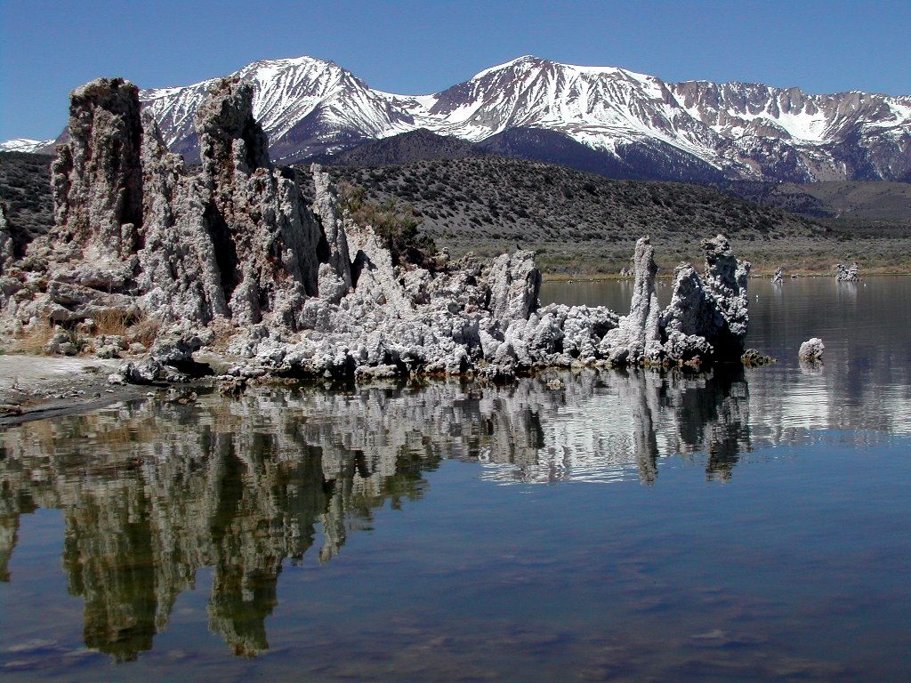 |
| Mono Lake, showing calcium carbonate “tufa tower” formations that originally formed beneath the lake but are now exposed after the water level dropped. The eastern flank of the Sierra Nevada range is shown in the background. (Photo by D. J. DePaolo.) |
Evidence for this drought was also discovered in an ancient lake situated east of the Sierra Nevada. Geography Professor Scott Stine analyzed the sedimentary sequences in Mono Lake, delineating patterns of alternately higher and lower lake levels for the past 4,000 years.
Mono Lake experienced an extended low stand that began about 1,600 years ago, dropping to an even lower level 700 to 1,200 years ago. During the 1980s drought, Stine also discovered large tree stumps submerged in Mono Lake.
Much like the tree stumps discovered in Lake Tahoe, these submerged trees indicated that at one time the lake was so small that its shoreline was several tens of feet lower than the present shoreline, when the trees now underwater could grow on dry ground. Stine went on to discover similar submerged tree stumps in lakes, marshes, and rivers throughout the central and southern Sierra Nevada Range.
By counting their growth rings, Stine determined that they had lived up to 160 years. Based on the amount the lake level dropped, he calculated that the average annual river flows in the region were only 40 to 60 percent of what they were in the late 20th century.
Radiocarbon dates of the outer growth layers of these tree stumps revealed that these trees clustered around two distinct periods, now known as the “Medieval Megadroughts”: CE 900 to 1100 and CE 1200 to 1350.
 |
| An ancient tree stump submerged in the West Walker River, eastern Sierra Nevada. (Photo courtesy of D. J. DePaolo.) |
Across North America, tree-ring studies indicate that climate conditions over the past two millennia became steadily more variable (shifting between drier and wetter periods), with especially severe droughts between CE 900 and 1400.
These records show that over half the American West suffered severe drought between CE 1021 and CE 1051, and from CE 1130-1170, CE1240-1265 and CE 1360-1382.
The warm and dry conditions of the Medieval period spawned larger and more frequent wildfires, as recorded in the trunks of Giant sequoias—the massive redwoods growing in about 75 distinct groves along the mid-elevations of the western Sierra Nevada. These spectacular trees can live up to 3,200 years or more, and have exceeded 250 feet in height and 35 feet in diameter.
Thomas Swetnam, the current Director of the Laboratory of Tree Ring Research at the University of Arizona, discovered that the trees carry scars on their annual growth rings that indicate past fires in the region.
Swetnam sampled giant sequoias from five groves between Yosemite National Park and Sequoia National Park, far enough apart that individual fires could not have spread from one grove to the next. He dated the trees using ring-width patterns, and recorded the fire scars contained within annual rings.
His analysis reveals that during the Medieval period, from 1,200 to 700 years ago, an average of thirty-six fires burned every century.
During the centuries preceding the Medieval period (from about 1,500 to 1,200 years ago) and immediately following it (from about 700 years ago to the current century), the fire frequency was substantially lower, with an average of 21 fires per century.
The Human Costs of Droughts Then and Now
The archaeological record suggests that the extended periods of drought in the Medieval era caused severe hardship for both coastal and inland peoples— particularly the ancestral Pueblo communities—as dwindling resources increased disease, malnutrition, and warfare. Long inhabited sites were abandoned as the desperate populations wandered in search of new water sources.
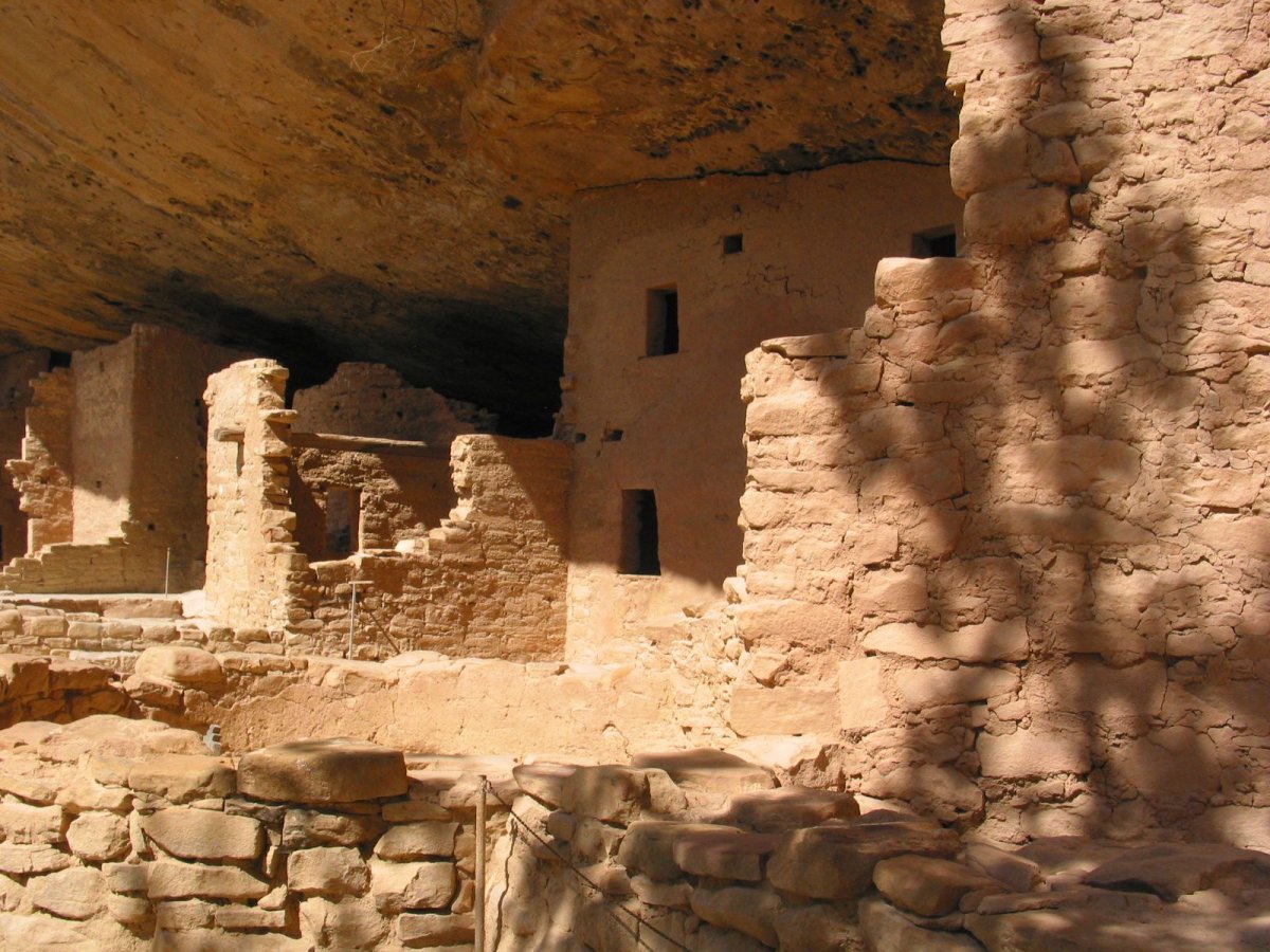 |
| Ancient pueblo cliff dwelling at Mesa Verde, southwestern Colorado. (Photo taken by B. Lynn Ingram) |
Much of what archaeologists know about the ancestral Pueblo comes from pueblo and cliff dwellings from the four corners region, including Chaco Canyon in northwestern New Mexico, Mesa Verde in southwestern Colorado, and Canyon de Chelly in northeastern Arizona.
Chaco Canyon in New Mexico was the site of one of the most extensive of the ancestral Pueblo settlements. At its peak, during the 11th and early 12th centuries CE, Chaco Canyon had great pueblos the size of apartment blocks housing hundreds of residents in large, high-ceilinged rooms.
These settlements were supported by agriculture, allowing people to settle in one place year-round. Most of the farming depended on annual rains, supplemented by water from nearby streams and groundwater.
But over time, the climate became increasingly arid and unpredictable. The ancestral Pueblo farmers were forced to build an extensive system of diversion dams and canals, directing rainwater from the mesa tops to fields on the canyon floor, allowing them to expand the area of arable land.
The population in the four corners region swelled throughout the 11th and 12th centuries CE—but then collapsed.
Another ancient society, the Hohokam, lived in central Arizona near the confluence of Arizona’s only three rivers, the Gila, Verde, and Salt. The Hohokam civilization thrived in central Arizona for a thousand years, building an extensive network of integrated canal systems, capable of transporting large volumes of water long distances.
At their peak, an estimated 40,000 Hohokam lived in Arizona, but they suddenly vanished in the mid-15th century.
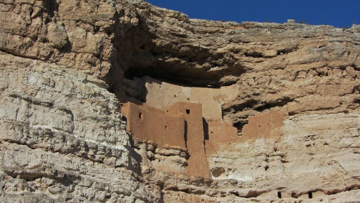 |
| Montezuma’s Castle, a cliff dwelling occupied by the Sinagua, located just north of Camp Verde in central Arizona. (Photo by B. Lynn Ingram.) |
In northern Arizona, between Phoenix and Flagstaff, the Sinagua culture also thrived during this period. As the climate turned drier, they built cliff dwellings in central Arizona, suggesting that resources became scarce, forcing them to build fortified dwellings with hidden food storage areas. The Sinagua also disappeared about the same time as the Hohokam.
All of these societies were flourishing prior to a rather abrupt collapse. The archaeological record of the last decades of the ancestral Pueblo in Chaco Canyon abounds with signs of suffering.
Skeletal remains show signs of malnutrition, starvation and disease; life spans declined and infant mortality rates increased. Evidence of violence, possibly warfare, was found in mass graves containing bones penetrated with arrowheads and teeth marks, and skulls bearing the scars of scalping.
Piles of belongings were found, apparently left behind as the people abandoned their settlements and fled, some to live in fortified hideouts carved in the cliff faces, protecting their hoarded food from enemies.
The unusually dry climate of the Medieval period also appeared to have tested the endurance and coping strategies of even the well-adapted native populations in California.
The skeletal remains show that life in the interior of California was particularly difficult, as the drought severely reduced sources of food (nuts, plants, deer, and other game). Settlements along rivers were abandoned, and trade between inland and coastal groups broke down. As water supplies dried up, conflicts – even battles – between groups arose over territory and food and water resources.
The Watery Lessons of the Past
The “Medieval Drought” serves as a model for what can happen in the West. It also provides an important impetus for water sustainability planning. And the hardships suffered by the first human inhabitants in the West provide important lessons.
For instance, during extended periods of abundant moisture, some societies experienced rapid population growth, leaving them vulnerable to collapse when the climate inevitably turned dry again.
Modern societies in the West have followed a similar path over the past century— after a century of fairly abundant moisture, the population in this region has exploded (and become more urbanized).
Modern engineering has allowed the exploitation of all available water sources for human use, and western water policy has favored water development for power, cities, and farms over sustainability of the environment and ecosystems.
These policies have allowed populations to grow to the limit that this region can support, leaving us vulnerable during extended drier conditions.
The longest six-year droughts experienced by the West over the past century are meager by comparison, despite the extreme hardship they brought to the region.
In fact, in the context of the longer-term climate history, the 20th century actually stands out as one of the wettest over the past 1,300 years, yet the droughts of the mid-1920s, 1977 and the late 1980s caused immense hardship for our society, based as it is upon heavy water usage.
In addition, future changes in the global climate will interact with the natural cycles of drought in California and the West in ways that are difficult to predict. Climate models predict that warming will likely make the extreme events, particularly floods and droughts, even larger and more frequent.
Some of these impacts have already begun. Over the past two decades, warming and an earlier start of the spring season have caused forest fires to become more frequent and intense.
A warmer climate will also bring less precipitation that falls as snow. The American West depends on snow-bearing winter storms for a natural water reservoir. This snow begins melting in the late spring, and continues into the summer, filling streams, lakes, and reservoirs that sustain natural ecosystems throughout the dry summer months.
The snow pack supports cities and irrigated agriculture, providing up to 80 percent of the year’s water supply across the West. As the region warms, the snow that does fall will melt faster and earlier in the spring, rather than melting during the late spring and summer, when it is so critically needed.
The message of past climates is that the range of “normal” climate is enormous—and we have experienced only a relatively benign portion of it in recent history. The region’s climate over the past decade has been dry when compared to the 20th century average, suggesting a return to a drier period.
This past year was also the warmest on record in the American West, and the ten hottest years on record occurred since 1997. The position of inhabitants of the West is precarious now and growing more so.
As we continue with an unsustainable pattern of water use, we become more vulnerable each year to a future we cannot control. It is time for policy makers in the West to begin taking action toward preparing for drier conditions and decreased water availability.
Read more from B. Lynn Ingram:
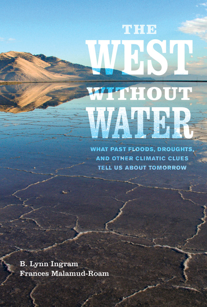 |
The West without Water: What Past Floods, Droughts, and Other Climatic Clues Tell Us about Tomorrow
by B. Lynn Ingram and Frances Malamud-Roam (University of California Press, 2013)
Benson, L., Kashgarian, M., Rye, R., Lund, S., Paillet, F., Smoot, J., Kester, C., Mensing, S., Meko, D. and Lindstrom, S., 2002. “Holocene Multidecadal and Multi-centennial Droughts Affecting Northern California and Nevada.” Quaternary Science Reviews 21, 659-682.
Bradley, R.S., Briffa, K.R., Cole, J., Hughes, M.K., and Osborn, T.J., 2003. “The climate of the last millennium.” In: Alverson, K, Bradley, R.S., and Pedersen, T.F. (Eds.), Paleoclimate, Global Change and the Future, Springer Verlag, Berlin, pp. 105-49.
Brunelle, A. and Anderson, R.S., 2003. “Sedimentary charcoal as an indicator of late-Holocene drought in the Sierra Nevada, California, and its relevance to the future. “ The Holocene 13(1), 21-28.
Cayan, D. R., S. A. Kammerdiener, M. D. Dettinger, J. M. Caprio, and D. H. Peterson, 2001. “Changes in the onset of spring in the Western United States.” Bull. Am. Met. Soc., 82, 399-415.
Fagan, B., 2003. Before California: an Archaeologist Looks at Our Earliest Inhabitants. Rowman and Littlefield Publishers, Inc, Lanham, MD. 400 p.
Gleick, P.H. and E.L. Chalecki. 1999.” The impacts of climatic changes for water resources of the Colorado and Sacramento-San Joaquin river basins.” Journal of the American Water Resources Association, Vol. 35, No. 6, pp.
Hughes, M.K. and Brown, P.M., 1992. “Drought frequency in central California since 101 B.C. recorded in giant sequoia tree rings.” Climate Dynamics 6,161-197
Ingram, B. Lynn and Malamud-Roam, F. (2013) The West without Water: What past floods, droughts, and other climatic clues tell us about tomorrow. UC Press, 256 pages.
Ingram, B. L., Conrad, M.E., and Ingle, J.C., 1996. “A 2000-yr record of Sacramento-San Joaquin River inflow to San Francisco Bay estuary, California.” Geology 24, 331-334.
Lightfoot, K., 1997. “Cultural construction of coastal landscapes: A middle Holocene perspective from San Francisco Bay.” In: Erlandson, J. and Glassow, M. (eds), Archaeology of the California Coast during the Middle Holocene, 129-141. Series, Perspectives in California Archaeology 4, Institute of Archaeology, Univ. of California.
Malamud-Roam, F. and B.L. Ingram. 2004. “Late Holocene d13C and pollen records of paleosalinity from tidal marshes in the San Francisco estuary.” Quaternary Research 62, 134-145.
Stahle, D. W., Cook, E. R., Cleaveland, M. K., Therrell, M. D., Meko, D. M., Grissino-Mayer, H. D., Watson, E., and Luckman, B., 2000. “Tree-ring data document 16th century megadrought over North America.” EOS Transactions of the American Geophysical Union 81 (12), 121-125.
Stine, S., 1990. “Past Climate At Mono Lake.” Nature 345: 391.
Stine, S., 1994. “Extreme and persistent drought in California and Patagonia during mediaeval time.” Nature 369: 546-549.
Swetnam, T.W. 1993. “Fire history and climate change in Giant Sequoia groves.” Science 262, 885.