In May 2019, during a visiting professorship at Nazarbayev University in Nur-Sultan (Astana), Kazakhstan, I took part in an expedition to the east of the country.
Kazakhstan is a vast, but sparsely populated country in Central Asia. It is located between two even larger and much more populous states: Russia to the north and China to the southeast. Once part of the Russian Empire of the tsars and then the Communist Soviet Union, Kazakhstan has been independent since 1991.
Our expedition was part of a government-funded project on the “Sacred Geography of Kazakhstan” that has produced an online atlas of sites of historical, cultural, and religious significance. The project’s aim is to develop tourism, but it is also part of a wider policy of promoting the distinctive identity of independent Kazakhstan.
Our expedition explored sites in the Eastern Kazakhstan Region—a remote region that is little known in the West yet contains fascinating examples of its history and culture with connections to the wider world.
There were four of us: project leader Dr. Nikolay Tsyrempilov; archeologist Aidyn Zhuniskhanov; historian (and our driver) Ulan Zhangaliev and me. Nikolay, Aidyn and I left Nur-Sultan on a sleeper train at about 3.00 pm on Wednesday, May 8. Nearly 18 hours and 500 miles later, we arrived in the city of Semey (formerly Semipalatinsk), where we met Ulan and his Nissan four-wheel drive SUV, in which we spent many, many hours over the following days.
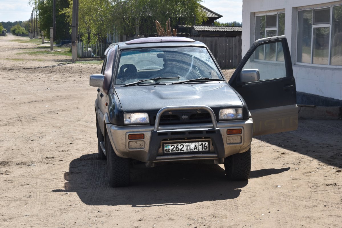
Ulan’s Nissan 4-wheel-drive SUV.
We headed south into dry, almost featureless steppe that resembles flatter parts of the arid American West such as Nevada. Another parallel with Nevada is that both regions had been used during the Cold War as sites for testing nuclear weapons. Fortunately for humanity, the Cold War remained cold, and the two sides never launched nuclear weapons at each other. But both sides tested hundred of nuclear weapons, at first in the atmosphere, later underground, in remote locations of their own countries.
Our journey from Semey to the village of Znamenka took us near the boundary of the Semipalatinsk Nuclear Polygon. Between 1949 and its closure in 1991, the Soviet military tested 456 nuclear weapons there.
In Znamenka, we heard horror stories from older inhabitants about the bomb tests. One recalled how they were warned to stay outside the following day as there was “going to be an earthquake.” We heard about, and met, people who suffered from chronic illnesses and cruel deformities as a result of the radioactive fallout.
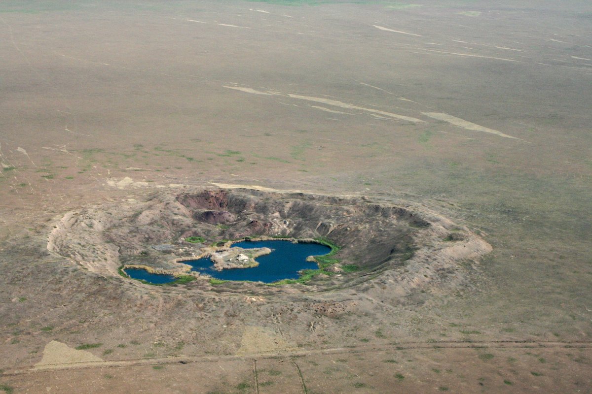
Crater from a USSR nuclear test at Semipalatinsk Polygon.
In marked contrast, in the same location, we experienced generous Kazakh hospitality: Aidyn invited us to share a meal with his family in the village.
Our next stop was the mausoleum and museum of the Kazakh national poet, Abai Kunanbaev (1845-1904). Abai occupies a similar position of esteem in Kazakhstan to William Shakespeare in the English-speaking world and Alexander Pushkin in the Russian world.
His mausoleum and museum are in the village of Karauyl, where he was born, before going on to attain prominence among Kazakhs and in parts of the wider world. There are statues of Abai in cities as far apart as Moscow, Beijing, Tehran, New Delhi, Cairo, and Berlin. His importance was recognized by UNESCO on the 175th anniversary of his birth in 2020.
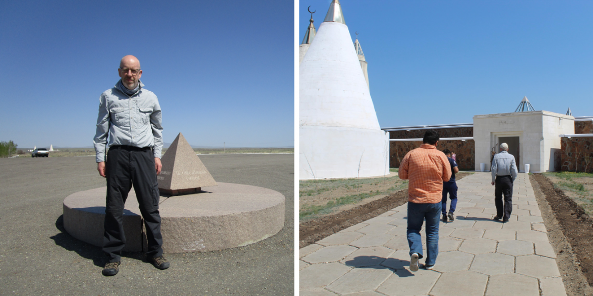
David at the Center of Eurasia (left). Aidyn, Ulan, and David approaching the Abai Mausoleum (right).
Nearby is a granite stone marking the center of the continental area of Eurasia, which extends out to China in the east, France in the west, the Arctic Ocean in the north, and India in the south.
Our journey took us on to a sacred site popular among Muslims: the Konyr-Aulie cave. Several busloads of pilgrims from all over Kazakhstan and adjoining regions of Russia had arrived before us. Nikolay interviewed some to learn about the importance of the site for them. An ethnic Kazakh family group, who had driven over 2000 miles from south-eastern Russia, invited us to join them for our evening meal. We spent the night in our sleeping bags in a large communal dormitory.
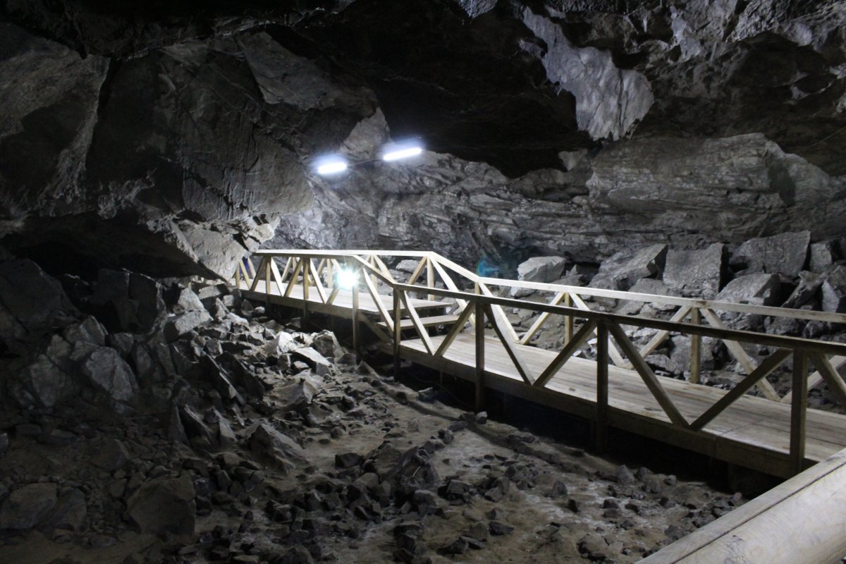
Path inside the Konyr-Aulie cave.
Some pilgrims rose at dawn to visit the cave and swim in its underground lake, which they believe has medicinal properties. We went after breakfast, climbing up to the cave’s entrance in a gap in the hillside, and making our way down a long passage to the lake. Archeologists believe that the cave has been a ritual site for people of various faiths for thousands of years. Despite the modern lighting and wooden path, we could sense the millennia of its history in the dark shadows and the lake’s eerily transparent water.
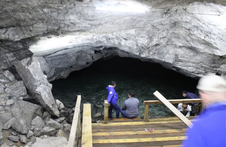
Underground lake inside the Konyr-Aulie cave.
We embarked on a long drive east to the town of Zaisan. Distances are enormous in Eastern Kazakhstan and the roads vary in quality due to the harsh, continental climate with temperatures ranging between – 40 F in the winter and + 100 F in the summer. Throughout our expedition, we drove for hours across sparsely or unpopulated steppe and desert, with few signs of human life for mile upon mile.
Around villages (auly) we saw herds of horses, sheep, cattle, and an occasional camel. But, gone for ever was the nomadic way of life of the Kazakhs who had lived in tents (yurts) as they migrated with their livestock between seasonal pastures. Brutal Soviet policies that compelled the nomads to settle in one place, followed by a devastating famine in the early 1930s that cost more than 1.5 million lives, ended a way of life that we could see only traces of in museums or echoes in the poetry of Abai.
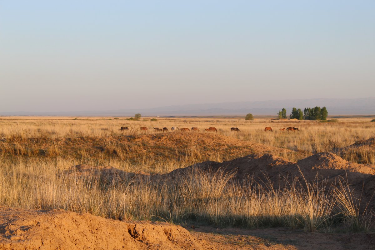
Herd of horses on desert-steppe.
After an overnight stay and visit to the local museum in Zaisan, we travelled to an archeological site of Buddhist monastery. To find it, Aidyn and Nikolay used sophisticated GPS equipment and the more traditional device of asking locals. We were so close to the Chinese border that we received “Welcome to China” messages on our phones. The monastery was built in the 17th century by Galdan Boshoktu. He was the ruler of the Dzungars (related to Mongols), who had invaded modern-day Kazakhstan from the east.
We then drove northwest, took a ferry across the Irtysh river, and on to the city known as Ust’-Kamenogorsk in Russian and Oskemen in Kazakh. In the outdoor ethnographic museum, I saw artefacts produced by the Kazakh population and by migrants from Russia who arrived in ever larger numbers from 18th century to exploit the region’s mineral resources and fertile land.
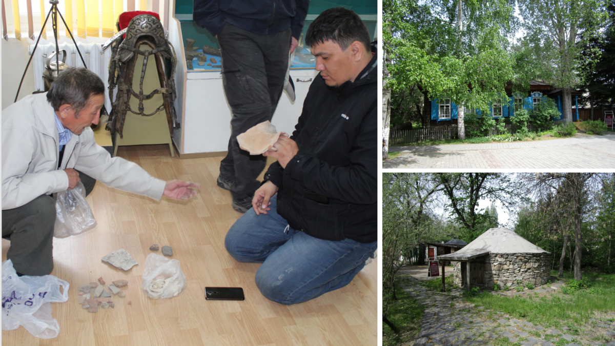
Aidyn and local historian examine artefacts in Zaisan museum (left). Kazakh stone house (bottom right) and Russian house (top right) at Ust' Kamenogorsk ethnographic museum.
The last leg of our journey brought us back to Semey. I visited the house where the famous Russian writer Fedor Dostoevskii (1821-81) lived for two years in the 1850s. He had been exiled from St Petersburg, the far-off capital of the Russian Empire, for sedition against the tsarist government. Dostoevskii was the author of such literary classics as “The Brothers Karamazov.” In Kazakhstan, he is remembered for his friendship with the Kazakh intellectual Shokan Walikhanov (1835-65).
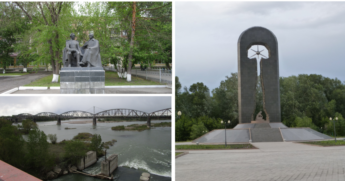
Statue of Dostoevskii and Walikhanov outside Dostoevskii museum, Semey (top left). Turk-Sib Bridge, Semey (bottom left). Stronger than Death (Silnee Smerti) monument to victims of nuclear weapons testing, Semey (right).
Another phase in the city’s history is recalled by the long bridge carrying the Turk-Sib railroad across the Irtysh River. Completed in 1930 during Stalin’s first Five-Year Plan, the railroad linked the cotton fields of Soviet Turkestan (Central Asia) with the grain belt of Siberia.
I spent the rest of the day at the profoundly moving memorial park and monument to the victims of nuclear weapons testing in the nearby Semipalatinsk Polygon. The monument bears the name: Stronger than Death (Silnee smerti).
Unless otherwise noted, all images are courtesy of the author.
Want to Learn More about Eastern Kazakhstan?:
Information on the “Sacred Geography of Kazakhstan” research project
Sacred Geography of Kazakhstan online atlas.
Joanna Lillis, “Kazakhstan: Living with Semipalatinsk’s Nuclear Fallout,” Eurasianet, Aug 26, 2016
Abai – Virtual exhibition to mark 175th anniversary, 2020
UNESCO marks Abai’s 175th anniversary
An article about book by Sarah Cameron, The Hungry Steppe: Famine, Violence, and the Making of Soviet Kazakhstan (Ithaca, NY: Cornell University Press, 2018)
Dostoevskii Literary Museum, Semey
Documentary film “TurkSib” (1929), English subtitles
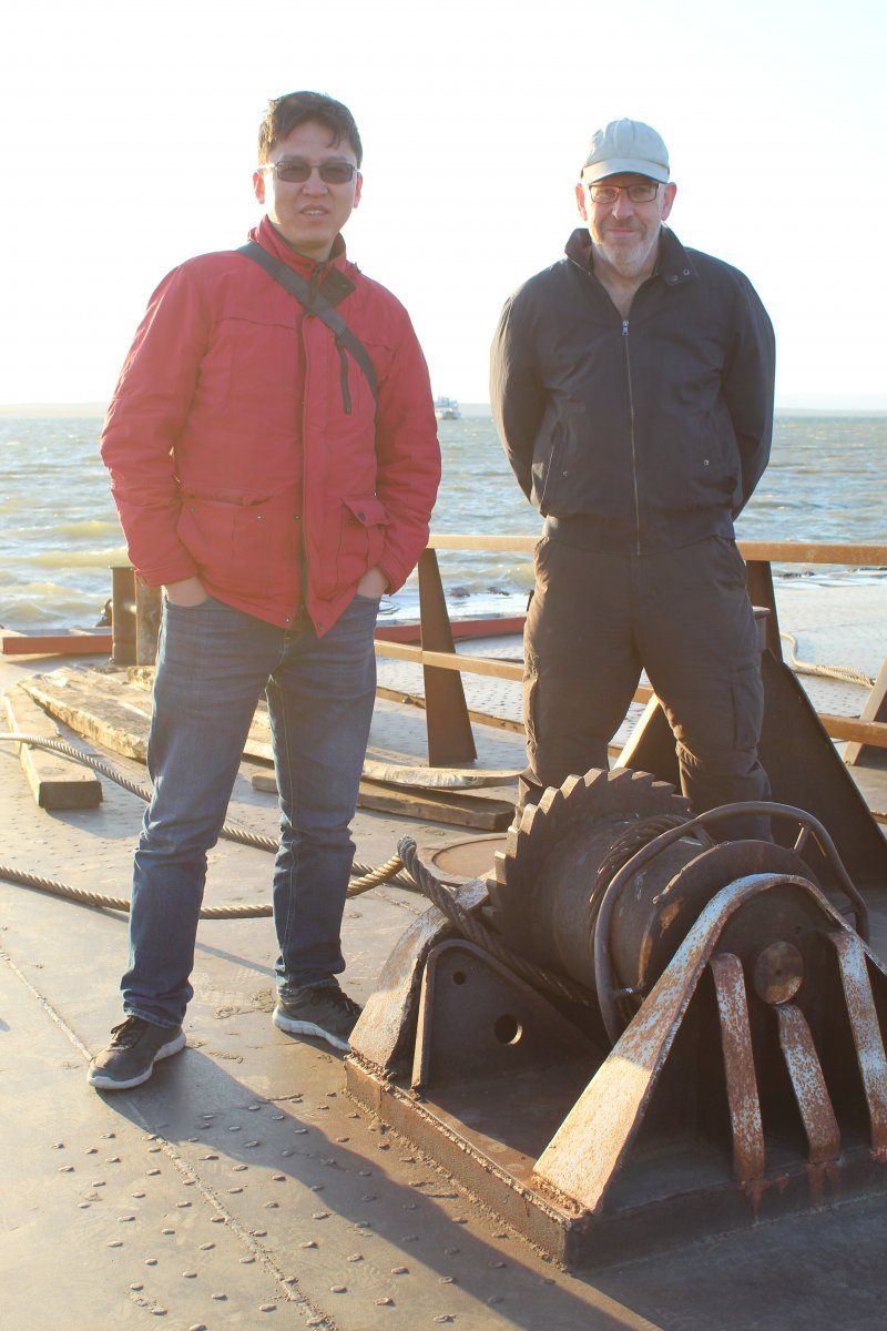
Nikolay and David on Irtysh Ferry.